
The Channel Islands Waterfront Homeowners Association (CIWHA)
The Channel Islands Waterfront Homeowners Association (CIWHA) is a volunteer association composed of owners of single family homes located in the Channel Islands harbor section of Oxnard, California. The primary mission of the CIWHA is to serve as a liaison between the City of Oxnard and the homeowners.
The Channel Islands Waterfront Homeowners Association began in 1970. It grew from the developers’ deed restrictions requiring there be a homeowner-controlled architectural committee. Although compliance with the covenants, conditions, and restrictions (CCR’s) is required of all homeowners, membership in the Association is voluntary. The Association does not own any common areas, nor does it contract out for any community services. Streets, sidewalks, green belts, and other infrastructure are publicly owned and maintained by the City of Oxnard.
Over the years the Association has brought homeowners together and has been responsible for efforts to beautify, protect, and enhance the area. With projects and committees running the gamut from seawall repairs and maintenance to water quality, landscaping, architecture review, police, security and noise abatement, volunteer homeowners have given thousands of hours to assure that Mandalay Bay maintains its distinct and comfortable laid-back ambiance.
Commonly known as Mandalay Bay, the marina north of Channel Islands Boulevard is surrounded by approximately 740 single-family homes. Most detached homes are located on the east side of the main channel, and most zero lot-line townhomes are located on the west side. All of the homes have adjacent docks which are individually owned. Each individual property has an Easement granted by the City of Oxnard. The City owns the seawalls and waterways in this development.
The original resolution to form our Waterways:
Resolution No. 5121: Resolution of Intention to Form a Waterway Maintenance Assessment District in the City of Oxnard
7 pages · Dated: May 26, 1970
City of Oxnard resolution declaring its intention to form a waterway maintenance assessment district, describing the district boundaries, maintenance purposes, financing method, and hearing procedures.
Resolution No. 5121: Resolution of Intention to Form a Waterway Maintenance Assessment District in the City of Oxnard
1. Purpose and maintenance scope of the proposed district
District boundaries legal description
2. Annual cost estimate and special assessment tax
3. Proceeding under the Improvement Act of 1911
4. Public hearing notice
5. Publication and certification
Followed by: Resolution No. 5,144
Dated: June 16, 1970
City of Oxnard resolution ordering the formation of a maintenance district pursuant to Resolution of Intention No. 5121.
Ordering the Formation of a Maintenance District
Followed by:
Resolution No. 5487
Dated: November 23, 1971
Three-page City of Oxnard resolution annexing Tract No. 2026-2 property into the Waterway Maintenance District, with legal boundary descriptions and adoption certification.
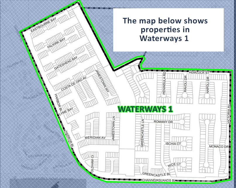
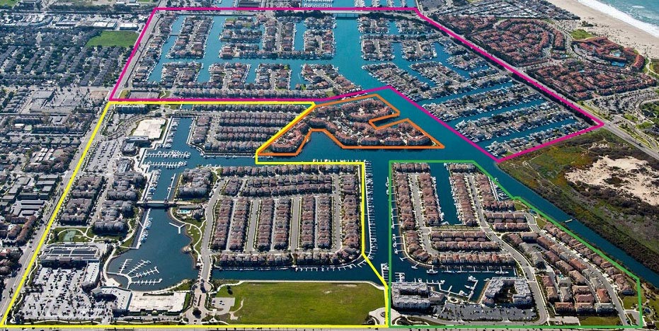
In the picture above our Development is outlined in pinkish purple.
The area in Orange is Harbour Island.
The area in Yellow is Seabridge.
The area in Green is Westport.
The Harbour Island community was built between 1988 and 1991.
The master-planned Westport at Mandalay Bay neighborhood in Oxnard was built between 2003 and 2007. Initial investment and planning for the community began as early as 1998, with the core residential properties constructed primarily between 2004 and 2006.
The master-planned Seabridge development in Oxnard was primarily built between 2006 and 2009.